Survey and inspection work, carried out from the air.

Roofs, chimneys, churches, commercial buildings, windows, sites and farmland — inspected and mapped without scaffolding, cherry pickers or anyone going up a ladder. Reports back within 2–3 working days.

CAA operational authorisation

£5m public liability insurance

Reports in 2–3 working days

Always independant

Eight services, one way of working

Every survey follows the same process, a permissions check, the flight, then a report you can actually use. Pick the one that matches what you need looking at.

Roof surveys

Tiles, ridges, valleys, flashing and flat roofs, the whole roof photographed in close-up without anyone leaving the ground.

Chimney surveys

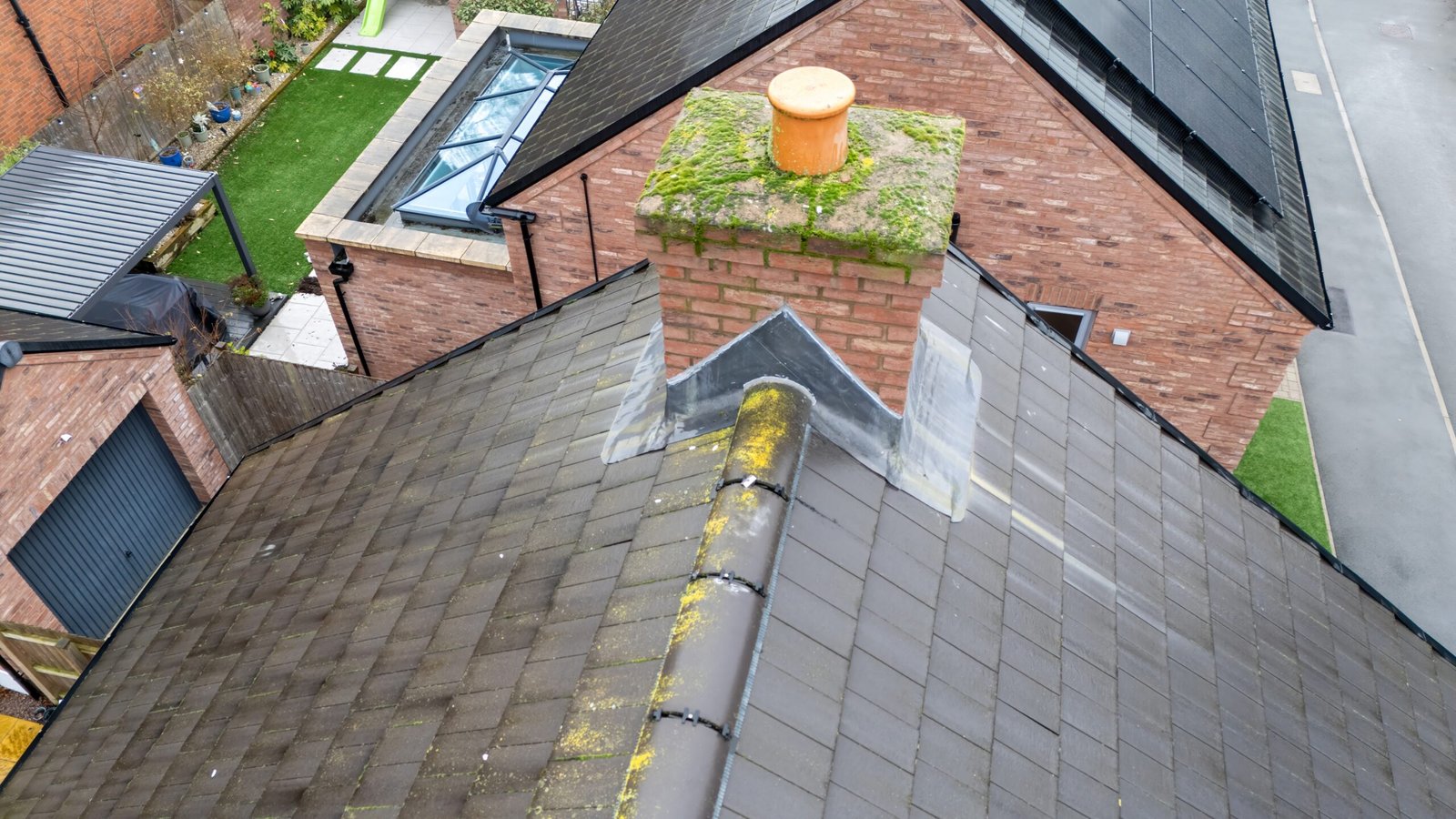
Cracked flaunching, slipped flashing, spalled brickwork. We get right up to the stack so you can see exactly what needs doing.

Church roofs

Towers, spires, parapets and leadwork on listed buildings, surveyed without scaffolding the nave or touching the fabric.

Building inspections

Cladding, render, gutters and high-level façades on blocks, commercial premises and taller structures.

Window surveys

Glazing and frames on upper floors and awkward elevations, photographed in detail.

Site surveys

Overheads, progress shots and area maps for construction sites and developments.

Farms & Agriculture

Crop health, field measurement, livestock checks and farm building inspections, the things that are slow to do on foot.

Residential Surveys

For a simple, one off £39, we can tell you if you have any issues with your roof.

What you actually get back

Every job finishes the same way, a set of high-resolution images, along with whatever measurements or data you asked for. If you’d like one, I’ll add a written condition report, a plain-English assessment of anything I noticed, so you’re not left squinting at photos trying to work out what matters.

From enquiry to report, in four steps

STEP 1

Tell us what needs looking at

A call or a form, building type, what’s prompted it, and roughly where you are.

STEP 2

We check permissions

Airspace, site access and any local restrictions are cleared before a date is booked in.

STEP 3

The flight takes place

I carry out the survey on site, on a date that works for you.

STEP 4

You get your report

High-resolution images and data delivered securely, with a written condition report if you’ve asked for one.

Surveys for farms, agriculture and land

Drones aren’t only for rooftops. For farms, estates and growers we cover the jobs that are slow, awkward or downright impractical to do on foot across arable, livestock and renewable land.

Crop health

Multispectral and NDVI imaging that flags stress, disease and drainage problems while there’s still time to act.

Field mapping

Accurate area, boundary and acreage measurement for planning, grant applications and land management.

Livestock checks

Quick stock counts and welfare checks across large or hard-to-reach grazing.

Barns & solar

Roof and structure inspections on barns and outbuildings, plus solar array and panel surveys.

Who I work with

I’ve surveyed for building and surveying firms, local councils, housing associations and plenty of private homeowners, alongside the more unusual jobs on tower blocks, hospitals, wind turbines and telecoms masts. Domestic roof or complex structure, the approach is the same.

Homeowners Commercial property Construction & new builds Agriculture & farming Churches & heritage Councils & housing Surveyors & builders Solar farms Wind turbines Telecoms masts Insurance

Get a quote

Send me the address and what you need looking at. I’ll come back with a price and a rough date, usually the same day.